
How to study history with maps: borders, empires and timelines

Algor Lab
November 8, 2026

Remembering that an empire was large does not explain how it worked. A map can show the extent of a domain without automatically revealing how it was administered, how stable it was or which communities lived there. Studying history with maps means reading space, time and the key together.
The scenes in Algor's World Through Time let you compare periods and territories, from the Roman world to Mongol domains. Begin with a historical question rather than a coloured area: what changes between two dates, which geographical connections matter, and what can the map not establish on its own?
Read the date before the empire's name
Territories change over time. A map of Rome in 117 CE does not represent the whole of Roman history. It depicts a particular stage of expansion at the end of Trajan's reign. Using it to describe the republic centuries earlier would be misleading even if every place name were correct.
Before taking notes, record the scene's date and historical period. Then identify whether it represents one year, an interval or a reconstructed maximum extent. Those are different choices. An area occupied briefly did not necessarily have the same relationship with the political centre as a province administered over centuries. The date is part of the evidence, not a decorative label.
Begin with seas, rivers and mountains
Look at the Mediterranean and describe the arrangement of Roman territories without reading every label. The sea connects coasts and ports, while mountains, rivers and overland distances create different challenges for movement and control. Physical and political maps answer complementary questions.
Avoid turning a geographical feature into a single universal cause. A river can be a frontier, a transport route or both at different times. Explaining why a boundary lies there also requires political decisions, conflicts and economic relationships. Geography helps generate a hypothesis; historical evidence helps assess it. Write the proposed relationship as a question before treating it as an established explanation.
One colour does not mean one uniform government
The Mongol territories shown for 1279 provide a useful example. The vast area associated with Mongol expansion contained different political entities. In the second half of the thirteenth century, fragmentation into khanates makes it inappropriate to infer identical central control over every region from one continuous coloured area.
A map may summarise territories connected to a dynasty or a historical expansion. To understand who exercised authority, how independently and at what date, combine it with historical writing. Area alone does not measure political unity, population or administrative effectiveness. A visually unified display can simplify relationships that require more careful explanation in words.

Compare two maps using the same question
Choose two dates and keep your region and comparison criterion fixed. Ask which territories entered or left a domain, which cities changed position relative to a frontier, or which routes became more important. Changing period, scale and topic simultaneously makes the transformation harder to identify.
Start with a descriptive statement: “This region falls within a different political area in the second map.” Then ask the causal question: “Which events produced that change?” A sequence of images is not a substitute for the answer. Seeing a before and after does not reveal all the intermediate steps, nor establish that the change had only one cause.
Use the quiz to retrieve knowledge
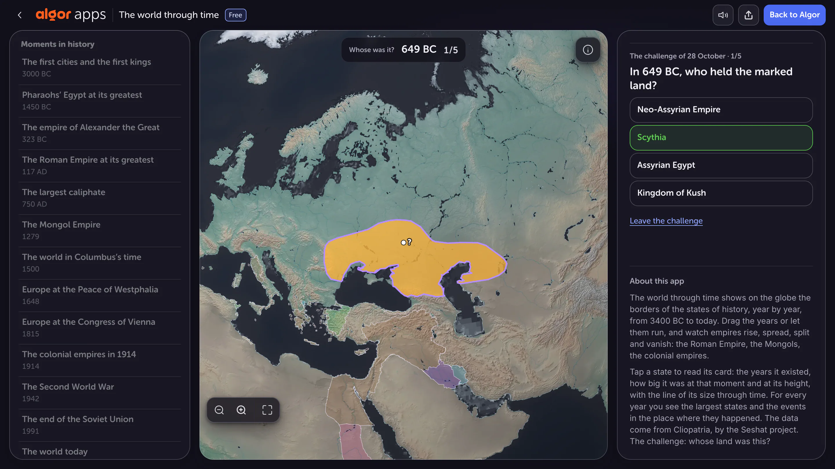
A question about who controlled a territory requires you to connect location and period. In the scene set in the seventh century BCE, the answer belongs to that historical context, not to present-day national borders. Recognising the modern location helps orientation but does not determine ancient political affiliation.
Before answering, identify two clues: the geographical region and the chronology. Afterwards, check which clue you misread if the answer was wrong. A location error requires different revision from a century error. The score gives an outcome, while your explanation tells you what to study next. This makes the quiz a diagnosis of understanding rather than a guessing exercise.
Recognise the limitations of drawn borders
Sharp lines make maps readable, but historical frontiers also included shifting zones of influence and contested areas. Not every boundary operated like a contemporary national border. Names and categories may also be adapted to make a reconstruction intelligible to present-day learners.
When a question depends on a precise boundary, investigate the source and specific period. Do not infer a uniform cultural identity from a political colour: language, religion, local practices and authority do not necessarily coincide. This qualification makes the map more useful because it identifies which questions the representation can actually help answer.
Link space and time in your revision
Make a one-page study guide with the date, region, observed change and explanation to investigate. For Rome, describe the Mediterranean's role. For Mongol domains, separate extent from organisation. For the quiz, record the geographical and chronological clues used in your answer.
Close the map and reconstruct the reasoning with a small sketch. You do not need to reproduce every boundary. Explain where something happened, when it happened and what limits apply to the representation. These connections turn a coloured map into a tool for historical understanding, including when you encounter a period you have not yet studied.
Sources and further reading


Faq
Frequently Asked Questions

Related articles
Get Started with Algor
Transform your content into structured, visual and personalized learning paths.


